
The University of Calgary offers the Bachelor of Science in Geography in its Faculty of Arts; this guide concerns that independent programme, not an INTIAU programme or partnership. Official degree record.
A geographical pattern depends partly on the way information is grouped and displayed. Two maps can use the same underlying observations yet encourage very different interpretations. Use a curriculum comparison to ask whether you enjoy moving between physical processes, human decisions and the methods used to represent their relationships.
Choose the precise degree
The department lists BA, BSc and honours versions separately. It describes technical work involving remote sensing, GIS, cartography and qualitative and quantitative analysis. Department programme guide.
The BSc admission tab refers prospective applicants to the calendar’s undergraduate degree admission requirements rather than supplying one universal school-system checklist. Programme admission route.
Sources were checked on 17 October 2026. The BSc title should not be confused with a degree in Environmental Science or with an honours research route. Record your intended entry term separately from the calendar edition. This guide gives no future application deadline, guaranteed course offering or personal assessment of eligibility.
Selected curriculum layers
| Layer | Published structure or example | Comparison question |
|---|---|---|
| Scope | Human geography, physical geography and methods | Which relationship interests me? |
| Major field | Specified courses plus required options | Which choices are genuinely open? |
| Advanced study | 500-level choices and upper-level options | Which earlier knowledge is needed? |
| Selected field example | GEOG 391 Field School; contact the department before applying | What preparation does field evidence require? |
The programme-details tab separates faculty, major-field and other requirements. Its online course sets should be checked directly rather than reconstructed from an older calendar.
The department’s FAQ distinguishes honours research and thesis work from the ordinary BA or BSc. This guide does not add an honours thesis to the BSc checklist.
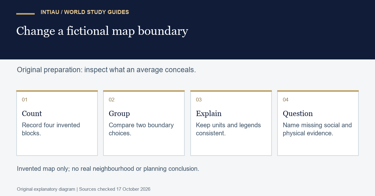
Worked exercise: change the map boundary
Draw four fictional neighbouring blocks on paper, labelled A to D. Assign each one hundred residents. Imagine that A and B each have forty trees, while C and D each have ten. The combined area has one hundred trees for four hundred residents: twenty-five trees per hundred residents. Show the calculation and label all values as invented.
Now group A with B and C with D. The two resulting zones have forty and ten trees per hundred residents. Group A with C and B with D instead, and both zones have twenty-five. The underlying fictional blocks have not changed; only the aggregation has. Explain why a map showing equal zone averages could conceal a difference visible at the block scale.
Add a second uncertainty. A tree count does not tell you canopy area, condition, shade at a particular hour or whether residents can access the space. Write one proposed observation for each of two competing interpretations. Keep the proposed data separate from the invented count already in your table. Do not use the exercise to describe an actual Calgary neighbourhood.
Create a legend with a clear unit and a neutral title. Give both grouping maps the same classification breaks so visual changes do not arise from an unnoticed alteration of the colour scale. Then write a caption explaining what stayed constant and what changed. A useful caption gives a reader enough information to question the comparison.
Finally, choose a conclusion that the evidence supports. You can say that grouping alters the visibility of differences in the fictional dataset. You cannot infer why trees differ between real places or prescribe an urban intervention. List the additional social and environmental evidence that a responsible real investigation would need.
Use the notebook to investigate study fit
Identify whether you most enjoyed constructing the map, checking the arithmetic, interpreting a physical feature or asking who might be hidden by an average. That distinction can guide your reading of course descriptions. Keep a sample output and a paragraph explaining its limits; attractive graphics without a defensible interpretation are a weak basis for comparison.
When building an application checklist, separate entry requirements from later course registration and field-course arrangements. Keep the exact degree variant at the top of every page. If a source has changed, ask the university which rules apply to your cohort rather than blending versions.
Frequently asked questions
Is the BSc located in the Faculty of Science?
The cited programme record places Geography BSc in the Faculty of Arts.
Does BSc automatically mean an honours thesis?
No. The department describes the honours research course and thesis specifically for the honours programme.
Can the fictional tree map describe a real area?
No. Its values and boundaries are invented. The exercise tests the effects of grouping, not conditions in a real neighbourhood.
View the study diagram
Official sources
For other independent study comparisons, see INTIAU Courses; general enquiries can use Contact. The named university decides its own admissions and academic requirements.